Game changing technology

How laser scanning and point cloud will influence architecture and design

Innovative design technologies get us excited at Lea Design Studio and we’ve put the spotlight on a leading surveying technology that’s impacting on architectural, engineering and construction work methods – laser scanning and point cloud modelling.

Point cloud models provide an accurate, streamlined design tool, offering a far superior outcome than the traditional 2D surveys or manual site measures that have been necessary in the past to create as-built drawings for use in renovations or extensions to existing buildings. In addition, laser scanning and point cloud technology can overcome the many challenges of building complex geometric designs, or applications such as modular construction where building tolerances require pinpoint accuracy.

What is a point cloud?

Point clouds are made up of multiple individual points located within space and identified by a three-dimensional coordinate system. En masse they create a see-through cloud of points that merely give an impression of the 3D surface of an object, much like a hologram, rather than represented as solid surfaces. This can include the interior and exterior of an object such as a building.
Typical Point Cloud model

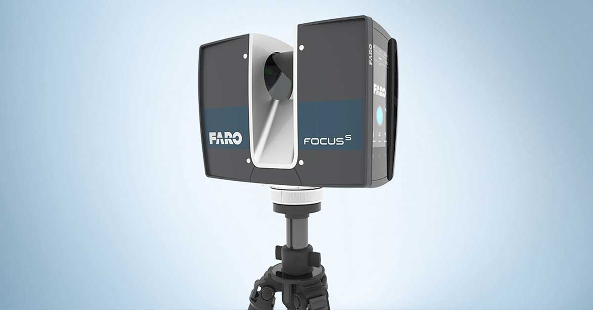
How are they created?

The collection of data points is generated by a 3D laser scanner mounted on a tripod. This laser is aimed at a mirror that spins vertically capturing a column of data, whilst the body of the scanner also spins horizontally, capturing a complete 360-degree dome of points.

The scanner is highly accurate and works at high speed, with capacity to collect almost 1 million points per second to an accuracy of +/- 2mm.

Since the scanner can only collect what is in its line of site, it is typically moved to multiple locations internally and externally to capture a full building survey.

Laser scanner

How are point clouds used?

The point cloud data can be used in many ways and has the capacity to provide a unique platform for collaboration with other users, offering game-changing data accuracy.

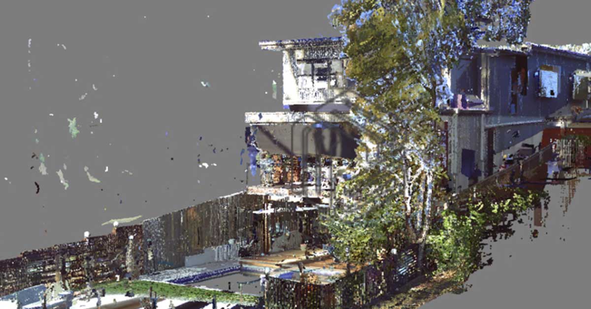
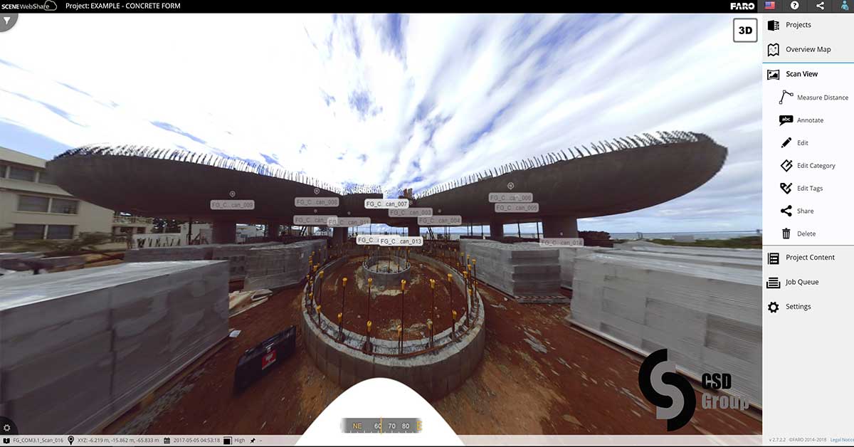
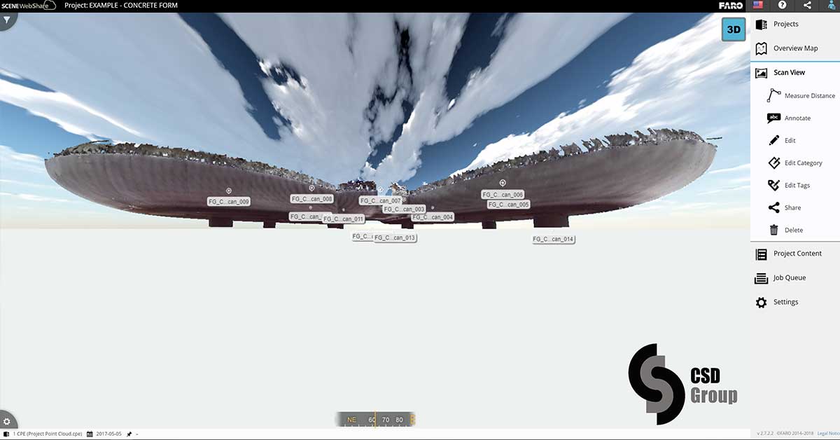
Retained in raw form as a “cloud of points”, the porosity of the 3D image makes it possible to see through walls and surfaces, exposing services and structure within ceilings and underfloor spaces if those spaces can be accessed to scan.

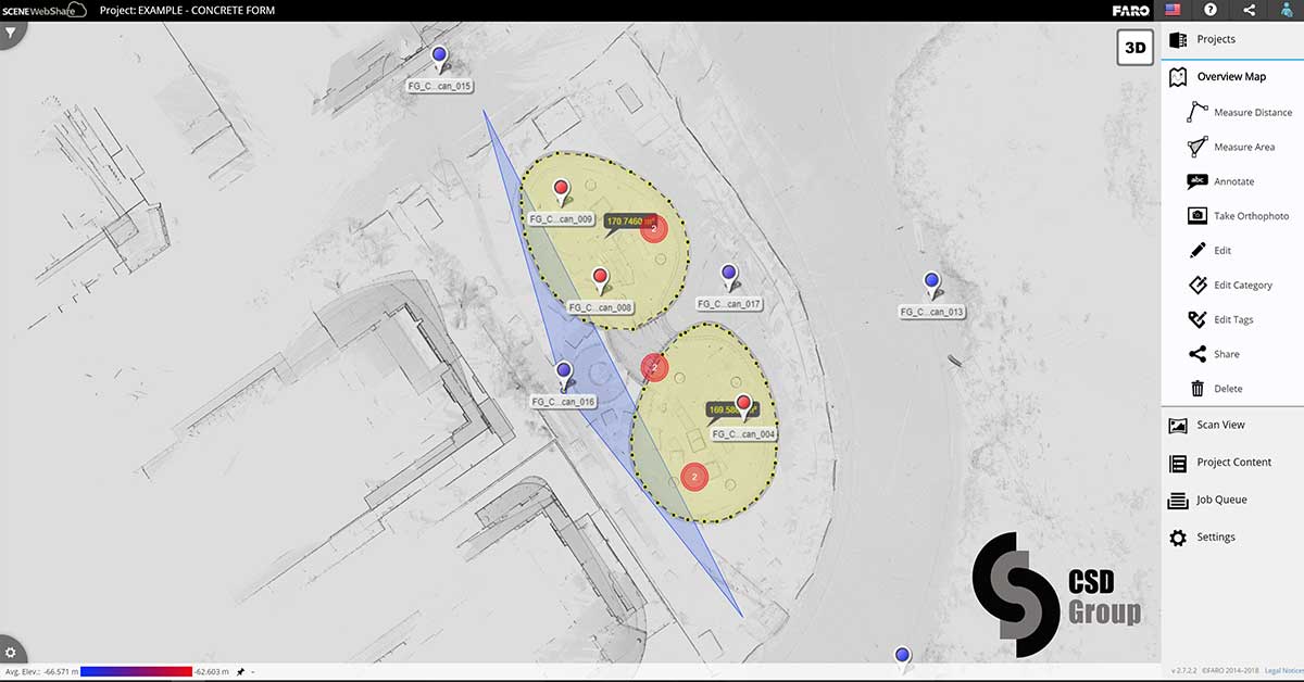
These point clouds can be shared online with multiple users who are able to view the existing design, navigate to a specific site location, inspect a photographic view of the point of interest, review new design modifications, add notes, or take measurements. As every pixel of the image is a 3D point, highly accurate measurements within +/- 2mm can be taken anywhere from within the point cloud model.

The point cloud data can also be converted into a polygonal model in various CAD formats, for use by architects, engineers and builders to create design and documentation drawings.

Plan view of 2 concrete floor pods captured by laser survey. The location pins identify the various survey positions used to capture a complete 3D point cloud model of the project. The view angle from a selected pin shown in future images is represented by the blue triangle (screenshot of online model)

What are the architectural applications of Point Cloud?

3D Laser Scanning has immense potential for aiding the process of architectural design from the early stages of site documentation and conceptualization, to monitoring construction progress and verifying as-built accuracy. This technology transforms labour and time intensive tasks, like hand measuring on site and eliminates room for error by delivering comprehensive data with pin point accuracy.

Aside from the obvious benefits of quickly and accurately creating detailed as-built drawing records of an existing building and its site, the data acquired through the process of laser scanning has a continued potential application throughout other stages of a typical architectural commission.

Point Cloud to BIM

Building information modelling (BIM) describes the process of designing a building collaboratively, that gives architecture, engineering, and construction (AEC) professionals the insight and tools to more efficiently plan, design, construct, and manage buildings and infrastructure using one coherent system of computer models rather than as separate sets of 2D drawings created remotely by each discipline.

Point Cloud scans are the ideal basis for converting existing buildings to BIM 3D models, thereby streamlining the collaborative design process.

Pre-Design

For projects requiring a renovation or addition to an existing space or building, the point cloud data overcomes the need for manual site measuring and the time-consuming conversion of that data into “as built” drawings, often necessary before any new design work can commence.

Design and Documentation

A point cloud model in conjunction with certain 3D CAD software programs, can be used in its native see through format as the foundation design tool used for adding new design elements or modifying the existing design. This eliminates the necessity to convert the point cloud into alternative solid surface 3D CAD models until such time as it is deemed necessary.

As any design involving an existing building develops, there are often elements that weren’t initially captured during earlier site visits that take on a new significance. A point cloud model will contain the minutia needed to promptly identify any details of the existing structure that may become important during the more detailed design stages and provide information that can assist in the production of new structural, mechanical, electrical, and hydraulic plans. This data retrieval could be as simple as zooming in on a label identifying the code on a piece of equipment, or measuring the diameter of a pipe. This eliminates multiple, repetitive trips to the site to obtain additional information that can waste valuable time and resources.

Design and Documentation

Laser Scanning, as an unobtrusive measurement method, allows the monitoring of the construction progress to verify the accuracy of work completed, or to provide accurate site measurement data for other contractors to use in manufacturing elements off site to fit into the new structure.
Perspective view captured by laser survey. Alternative views can be chosen by selecting other location pins and then orbiting / scrolling within the model to the point of interest. (screenshot of online model)
Point cloud version of the previous photographic image with extraneous information removed for clarity (screenshot of online model)
Whether employing it as an instrument of quality control, verifying contract fulfilment, or identifying and resolving clashes between design intent and site condition reality, laser scanning provides a comprehensive documentation of the existing site conditions unmatched by other technologies. Existing reference points from the original scanning and registration process allow for seamless integration of new works and immediate clash detection prior to installation.

Post Construction

Most larger projects require the production of as-built drawings recording the final built environment which can often vary from the original construction drawings prepared due to design variations that may have occurred during the project.

If the design utilised a point cloud model throughout the course of the project, then any changes are likely to have been captured at the time they were initiated.

If not, then a laser survey of the completed building will provide a detailed point cloud model documenting exactly what was constructed.

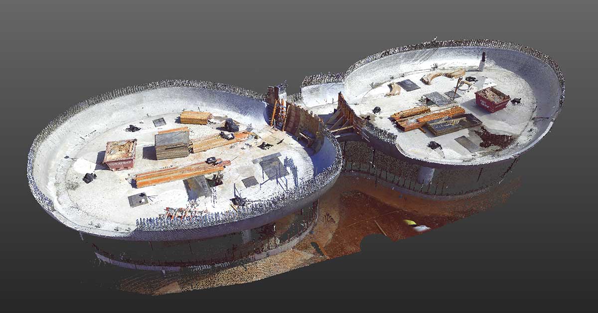
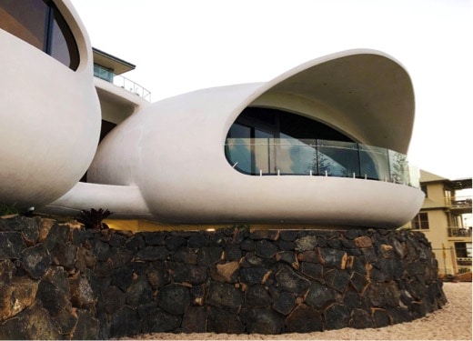
Point Cloud technology in application – Residential Project, Point Danger

A recent residential project at Point Danger, Tweed Heads demonstrates how point cloud technology can be utilised to assist with the design and construction process.

Comprising two interconnected organic ovular shaped pods, the complex geometry made this a challenging project to construct. Whilst the curved freeform base was constructed using traditional plywood formwork curved to the desired profile, forming the curved concrete walls and roof over in the same manner was deemed to be too difficult and costly to achieve the accuracy and tolerances required.

The solution adopted was to laser scan the curved building base providing an accurate point cloud 3D model of the existing structure.

A laser survey image, one of multiple scans used to create a point cloud model of the existing structure (screenshot of online model)
The curved roof was designed to suit this exact model, and then utilised by Movie World set designers to CNC cut highly accurate curved polystyrene blocks to act as the formwork for the concrete shell. Transported in multiple pieces, when installed on site they matched exactly the profile of the existing structure and ensured a perfect mould from which the balance of the concrete pods could be constructed.
At Lea Design Studio, we like to be at the forefront of modern technology that improves the services we can offer to our Clients. We are now using laser scanning and point cloud models as the basis for all major renovation projects, and anticipate as the technology continues to develop, multiple alternative applications for its use will become apparent.

Contact us to discuss how the application of point cloud technology can streamline your next project.

0 Comments

Continue Exploring